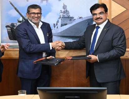
 Bharat Electronics Limited (BEL) and Esri India have signed a Memorandum of Understanding (MoU) to jointly develop advanced Geographic Information System (GIS) and GeoAI solutions for India's defence sector. The partnership aims to strengthen operational readiness, situational awareness, and indigenous geospatial capabilities under the Make in India initiative.
The collaboration combines BEL's expertise in defence electronics and systems integration with Esri India's capabilities in GIS, location intelligence, and GeoAI. Building on previous joint projects, the two organisations will work together to deliver mission-ready geospatial solutions for India's armed forces while expanding cooperation across strategic defence programmes.
As part of the agreement, Esri India will provide specialised training to BEL through its Indo ArcGIS platform, enabling the company to develop in-house expertise in GIS and GeoAI technologies. This is expected to enhance BEL's ability to deliver advanced geospatial solutions independently and reduce reliance on external providers.
The partnership will support the integration of geospatial intelligence with emerging technologies such as artificial intelligence, IoT, cloud computing, big data analytics, and unmanned systems. By combining advanced mapping, location intelligence, and AI-driven analytics, the collaboration aims to provide defence forces with improved operational coordination, faster decision-making, and enhanced battlefield awareness.
Bharat Electronics Limited (BEL) and Esri India have signed a Memorandum of Understanding (MoU) to jointly develop advanced Geographic Information System (GIS) and GeoAI solutions for India's defence sector. The partnership aims to strengthen operational readiness, situational awareness, and indigenous geospatial capabilities under the Make in India initiative.
The collaboration combines BEL's expertise in defence electronics and systems integration with Esri India's capabilities in GIS, location intelligence, and GeoAI. Building on previous joint projects, the two organisations will work together to deliver mission-ready geospatial solutions for India's armed forces while expanding cooperation across strategic defence programmes.
As part of the agreement, Esri India will provide specialised training to BEL through its Indo ArcGIS platform, enabling the company to develop in-house expertise in GIS and GeoAI technologies. This is expected to enhance BEL's ability to deliver advanced geospatial solutions independently and reduce reliance on external providers.
The partnership will support the integration of geospatial intelligence with emerging technologies such as artificial intelligence, IoT, cloud computing, big data analytics, and unmanned systems. By combining advanced mapping, location intelligence, and AI-driven analytics, the collaboration aims to provide defence forces with improved operational coordination, faster decision-making, and enhanced battlefield awareness.On Date: